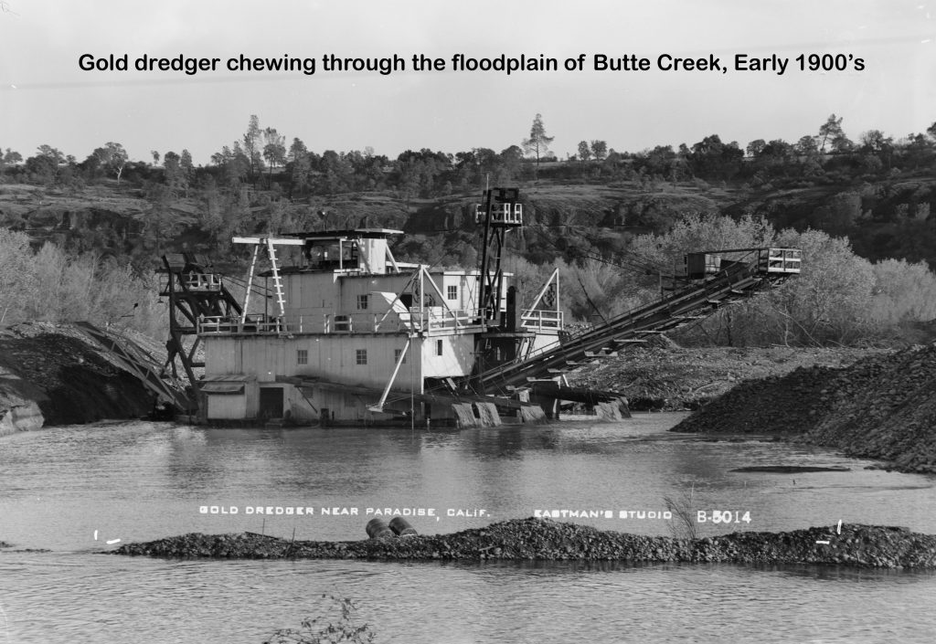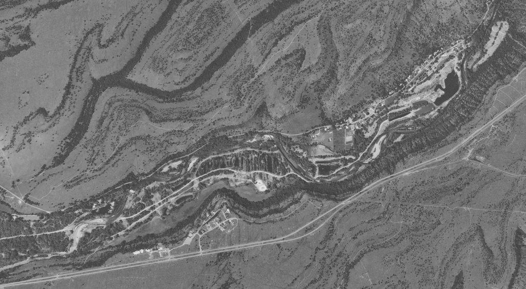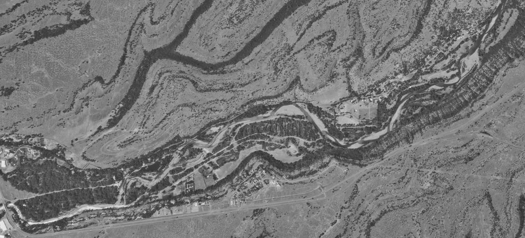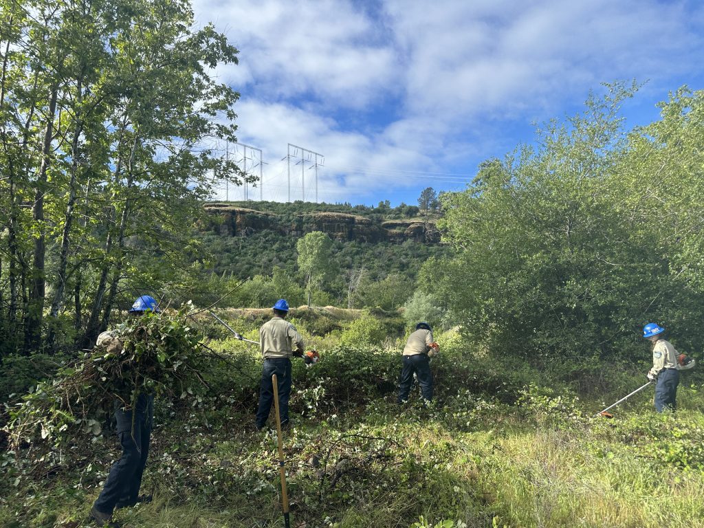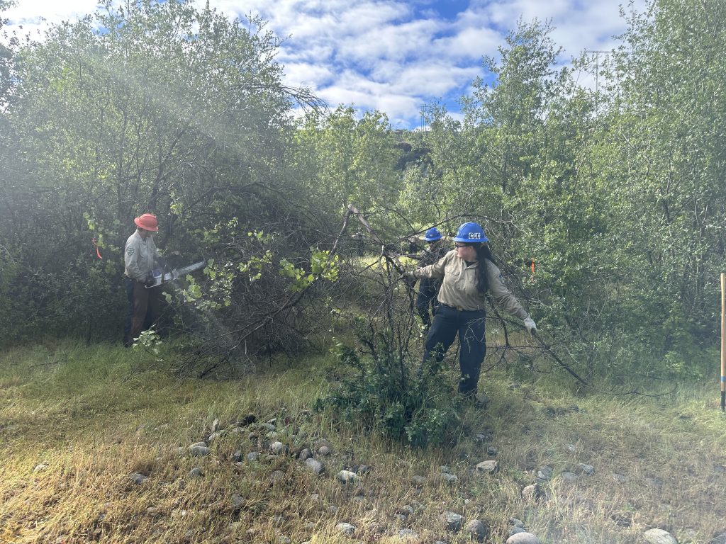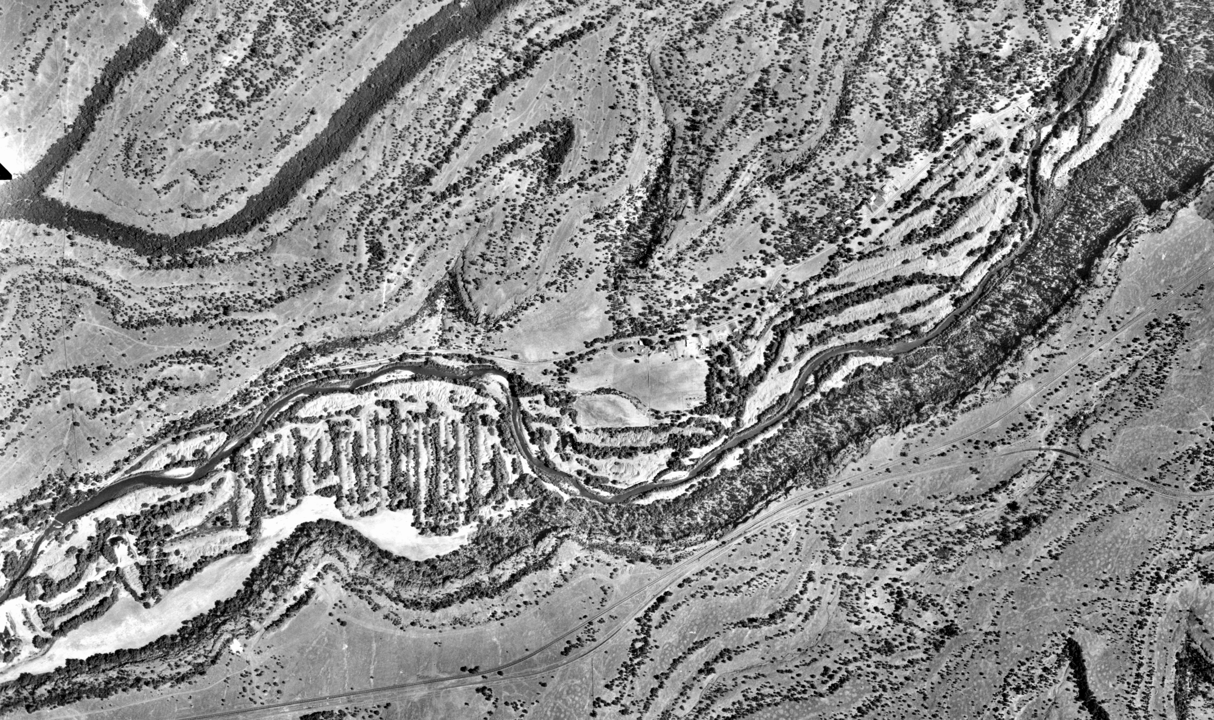
After more than two years of project development, design and evaluation, we have officially started the first phase of this multi-year project to restore the condition and functionality of the floodplain in lower Butte Creek Canyon on the California Department of Fish and Wildlife Ecological Reserve. This area was mined multiple times, first by large gold dredgers and later by sand and gravel extraction equipment. The featured image is from 1962 after all the dredgers were gone. Sand and gravel mining continued into the 1980’s which created a series of large ponds, some linear and some more rounded. The upstream (to the right) ponds in the 1984 photo were the site of the approved development of 72 condos surrounding the ponds. A citizen initiative got the project on the Butte County Election ballot and the project was overwhelmingly rejected by the voters. The most recent photo from 1998 shows how the creek changed course in the 1986 flood and obliterated the condo ponds. Disaster averted thanks to the public! The last photos show the California Conservation Corp crew members opening up access to one of the pond for survey work and installation of piezometers (groundwater monitoring wells). Lots more work to come and we are excited to get started!